| 704.694.4181
1963 - 2013
"Serving Anson County for 50 Years"


About Anson County
 Anson County, once the largest in the state with a border on the Mississippi River, was carved from Bladen County in 1750. It was named for Lord George Anson, a British admiral. The first courthouse was built on the bank of the Pee Dee River at Mount Pleasant. Anson is a largely rural area with 536 square miles and a population of 25,275 (2000 Census). Located in the south central region of North Carolina, the county is bordered by Richmond, Stanly and Union counties, and Chesterfield County, S.C. The county seat is Wadesboro. Anson enjoys a mild climate, with an annual average temperature of 76 degrees Fahrenheit. January is the coldest month, with an average temperature of 42.5 degrees. July is the hottest, with an average temperature of 78.9 degrees. The annual average rainfall is 41.52 inches. Centrally located, Anson is approximately one hour from Charlotte (50 miles), two hours and 10 minutes from Raleigh (115 miles) and two hours from Greensboro (100 miles).
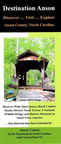 Destination Anson Brochure Available
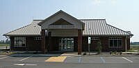
The Chamber's primary function is community development. This includes development of industry and trade; and handling civic activities, publicity and public relations for the community. As the "front door" to the community, the Chamber welcomes newcomers, visitors, and others who are making inquiries concerning the county and its municipalities.
Click the image to see the entire brochure.
The Municipalities of Anson County
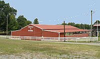
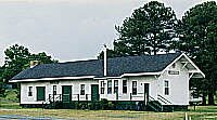
 Ansonville
Ansonville was first settled in 1844. The settlement became Ansonville in 1857 and was incorporated in 1885. Ansonville was the home of Carolina Female College (1850-1867), with was established by local planters and aided by Methodists. Several Antebellum homes remain today. The Gaddy Wild Geese Refuge, which closed in 1957, was well known to nature lovers across the state. The Pee Dee National Wildlife Refuge is located south on U.S. 52. Population: 636 | Altitude: 324 feet
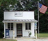
Lilesville
 Although a post office was established as early as 1828, the town was not incorporated until 1874. The town is generally thought to be named after merchant Nelson P. Liles, although claims have been made in favor of Elijah Liles and Ephraim Liles. William Blewett purchased land along the Pee Dee River in 1758 where he operated a ferry and a fishery. In 1905, the Blewett Falls site was chosen for a hydroelectric power plant. Population: 459 | Altitude: 474 feet | www.townoflilesville.org/
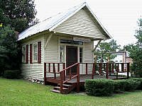
 McFarlan
Named for Allan McFarland, president of the Cheraw and Salisbury Railroad, the 1900 Census dropped the 'd'. A post office was established in 1883 when the post office at Sneedsborough closed. The town was incorporated in 1885. John Grady of McFarlan served in the General Assembly in 1836; and, in 1928, Susan Braswell became one of the first female mayors in North Carolina. Population: 89 | Altitude: 297 feet
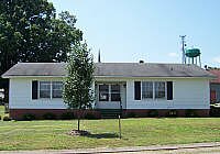
Morven
 A post office was established in 1823 and named for Morven, Scotland, the home of Esperon Cameron McKenzie, mother of Hugh McKenzie, the first postmaster. When the Cheraw and Salisbury Railroad came through, the settlement moved to its present site. The town was incorporated in 1883. In the War Between the States, Sherman's troops encamped at the plantation, Loch Adele. Yankee raiders burned most of Old Morven. Population: 579 | Altitude: 341 feet
Peachland
 Originally Mulcahy, the town was renamed in 1888 for the peach orchards owned by Pad Gray. Peachland was incorporated in 1895. A Peachland physician, Dr. Parks Turner Beeman, is known for successfully feeding fever patients while other doctors preferred to starve them. His epitaph reads: "I Fed Fever." The area was once known for its gold-panning. In 1814, Lawyers Spring Primitive Baptist Church was started. Lawyers, on horseback from Charlotte to Wadesboro, camped at one of the many springs in the area. Population: 554 | Altitude: 446 feet
Polkton
 Incorporated in 1875, the town is named for Leonidas Lafayette Polk, a state agricultrual leader who startedProgressive Farmer. When the railroad came through the county, it passed through his farm. He envisioned the town being called Luneville. Journalist Harllee Branch Sr., who was city editor and a Washington correspondent with the Atlanta Journal, was from Polkton. He was chairman of the U.S. Civil Aeronautics Board. Population: 1,195 | Altitude: 320 feet
Wadesboro
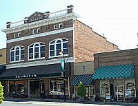
 Established in 1783 as the county seat, Wadesboro was called New Town until 1787 when the name was changed to honor Revolutionary War patriot Col. Thomas Wade. Wade's brother-in-law, Patrick Boggan, was a pioneer settler. Future president Andrew Jackson was issued his license to practice law from the County Court of Anson; and future judge Samuel Spencer's first law office was in the new log courthouse. In 1900, scientists from the United States and Europe gathered in Wadesboro to observe a total eclipse of the sun. Population: 5,746 | Altitude: 423 feet | www.townofwadesboro.org/